|
| *****SWAAG_ID***** | 957 |
| Date Entered | 21/10/2016 |
| Updated on | 21/10/2016 |
| Recorded by | Tim Laurie |
| Category | Burial Mounds and Cairns |
| Record Type | Archaeology |
| SWAAG Site | Reeth Low Moor |
| Site Access | Public Access Land |
| Record Date | 21/10/2016 |
| Location | Reeth Low Moor. Cringley Bottom. |
| Civil Parish | Reeth |
| Brit. National Grid | NY 99846 00233 |
| Altitude | 365m |
| Geology | Glacial drift over strata above the Middle Limestone. |
| Record Name | Reeth Low Moor. Historic Landscapes. 19m diameter Denuded Round Cairn on Cringley Bottom |
| Record Description | NY99846 00233 or 399846 500233. RTH 010 on Survey Maps below. Round cairn 19m diameter located on open moorland some 200m north of the stone wall of the enclosed Pastures above Barney Beck. This large round cairn has been severely reduced by quarrying and has supplied much stone for the nearby dry stone walls.
However a sufficient remnant of the stone core of this cairn survives to define the minimal extent of a cairn once at least 19m diameter.
This cairn is the largest of a substantial number of stone cairns located on the wide moorland terrace below Cringley Hill. The two maps below are extracts from the SWALB EDM survey of prehistoric monuments of Reeth Low Moor with later amendments following additional fieldwork. |
| Dimensions | Remnant of stone round cairn 19m diameter |
| Additional Notes | Image No One below shows the perimeter of this cairn as marked by a group of Friends of the Swaledale Museum during a field walk over Reeth Low Moor.
Reference: Tim Laurie, 2011. 'Archaeological landscapes of Reeth Moor', Proceedings of the Lawrence Barker Conference, 10 September 2011, Fremington North Yorkshire. In: British Mining No 92, Memoirs 2011, pp37-58.
Now available in the Publications Section of this Website. |
| Image 1 ID | 7001 Click image to enlarge |
| Image 1 Description | Reeth Low Moor.Cringley Bottom. Perimeter of the remnant of a 19m diameter round cairn marked by a group of Friends of the Swaledale Museum. | 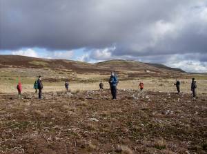 |
| Image 2 ID | 7005 Click image to enlarge |
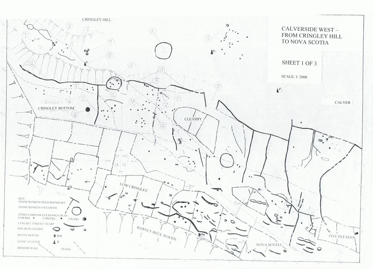
| Image 2 Description | Reeth Low Moor West. Westernmost section of the Three Sections of the SWALB EDM Survey of Reeth Low Moor with later amendments as Laurie et al. 2011, Figure 6.12. | 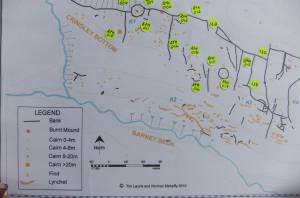 |
| Image 3 ID | 7003 Click image to enlarge |
| Image 3 Description | Prehistoric monuments, Reeth Low Moor West including early settlement evidence at Cringley Bottom. Prehistoric monuments at Cringley Bottom. Extract from the digitised version of the SWALB EDM Survey of Reeth Low Moor with later amendments as Laurie et al. 2011, Figure 6.12. | 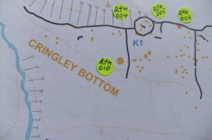 |
| Image 4 ID | 7002 Click image to enlarge |
| Image 4 Description | The original SWALB EDM Survey of Reeth Low Moor West. | 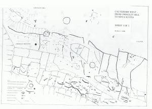 |
| Image 5 ID | 7004 Click image to enlarge |
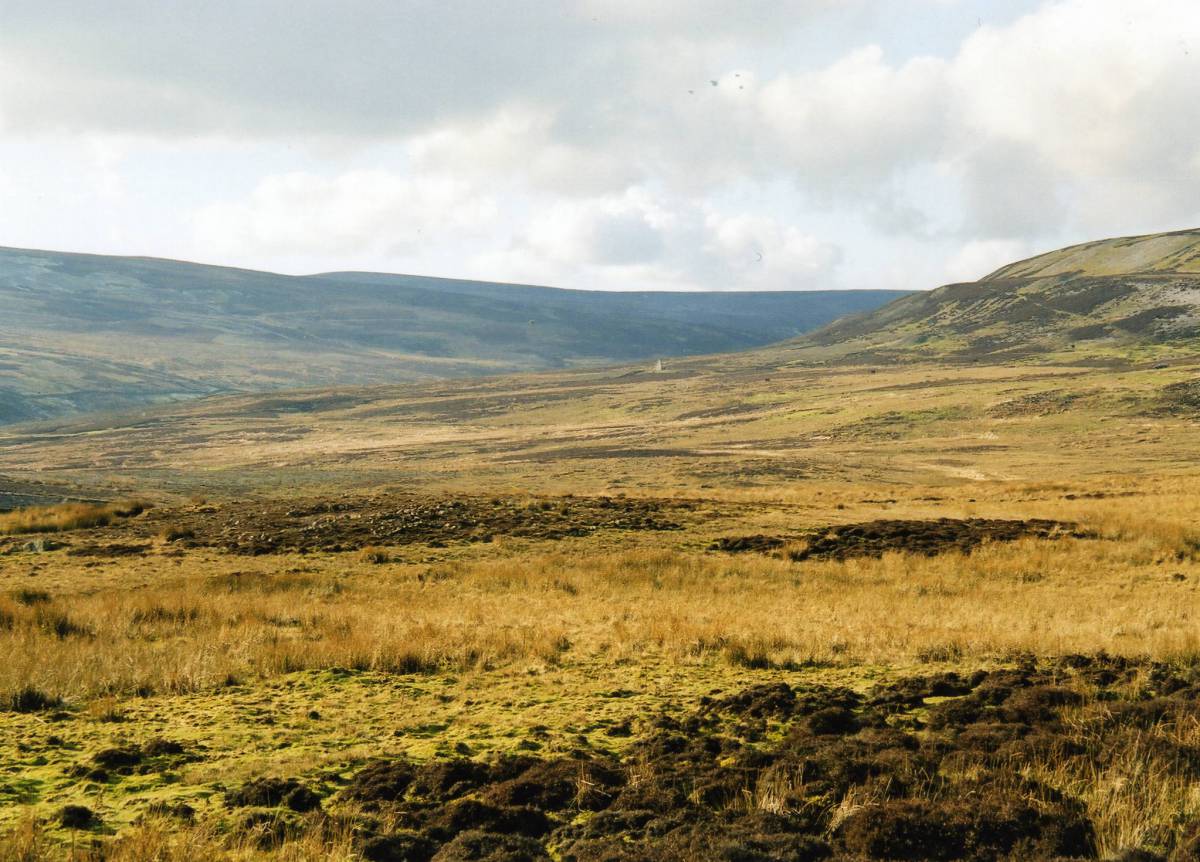
| Image 5 Description | View westward across the Bronze Age Cairnfield and the Coaxial field system on Cringley Bottom. | 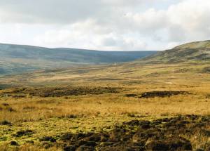 |